Melissa Gaskill and I just set out on the Great Gulf Coast Oil Spill Reporting Road Trip Adventure, from Houston to Florida and back. We are both reporting for Texas Parks & Wildlife Magazine on the impact of the oil spill. And we each have other assignments, and are looking for more stories to tell. I will be doing podcasts/slideshows this week (which will appear throughout the month) for Adventures in Climate Change - the Wendee Holtcamp Report, and videos will be forthcoming as well. Here we are inside Mosaic, a hookah bar (my first) and restaurant in Ocean Springs, Mississippi - our first destination. No I did not try the hookah pipe! But the food was delicious!!
  When we got to Ocean Springs, Mississippi, we walked on the beach for a few minutes. The boom here is placed around a manmade rock jetty, and we weren't quite sure what it was protecting there. It appeared to separate the seaweed on one side compared to the other but we didn't see any visible oil. After speaking with several biologists in the area, I did learn that quite a bit of oil has hit the region, though.
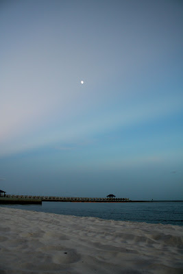 The moon was rising and the sun was setting. It was a beautiful white sand beach, but no dunes.
 Sunset over the coastal marsh grass and beach.
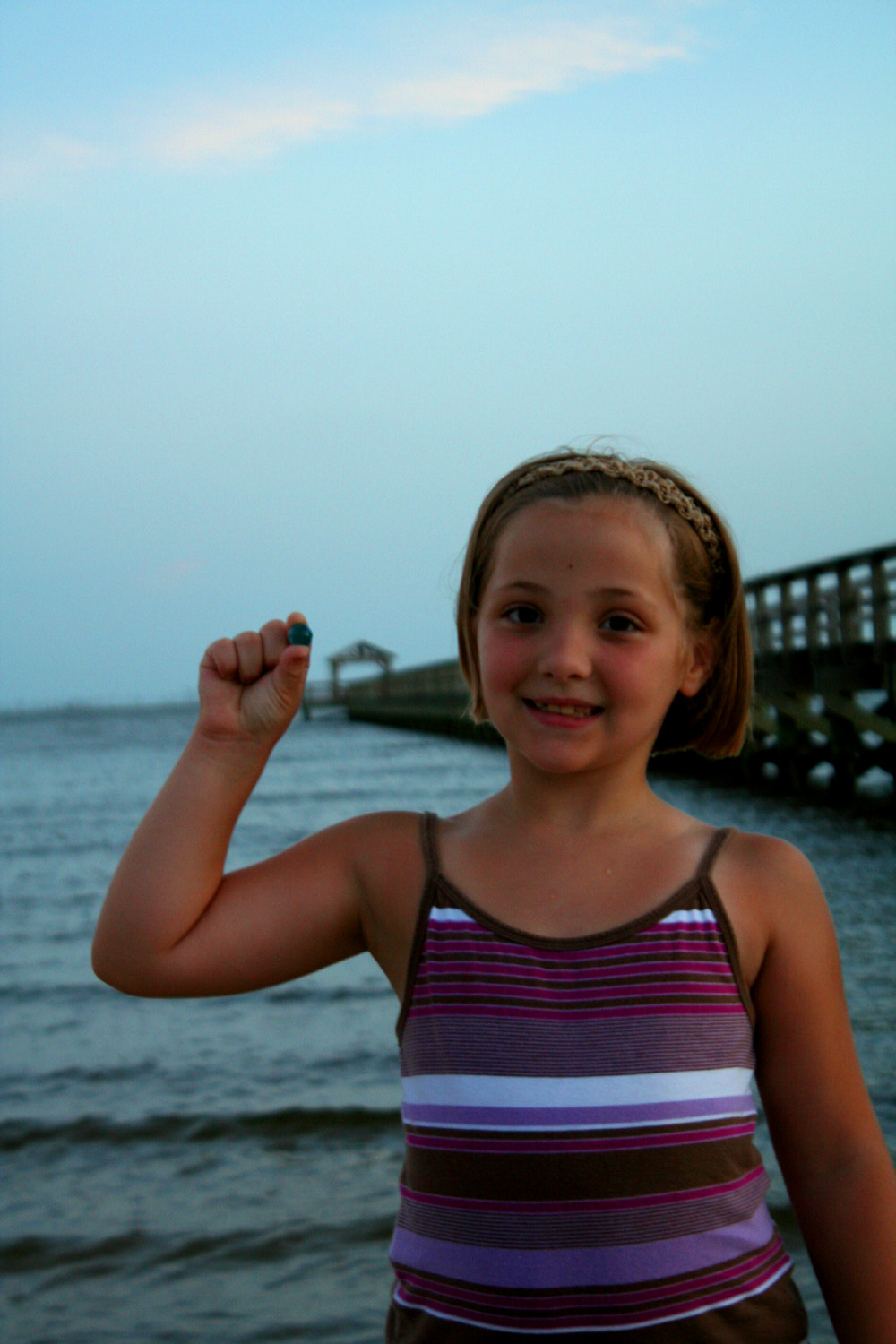
 This girl was part of a family that we met on the beach and we gave them a couple of blue marbles. We will be doing this throughout the trip, taking pictures, and recording video stories about the ocean. Check out bluemarbles.org for more info - saving the ocean one blue marble at a time, through random acts of ocean kindness! The family lived in Ocean Springs and the mom had a business making jewelery from oyster shells she would find on the beach. Cool!
 A shot of the Ocean Springs marina at dusk.
 A sticker on the door of one of the the Gulf Coast Research Laboratory (affiliated with University of Southern Mississippi) buildings. We came here in the morning, and met first with Dr. Mark Peterson who studies sturgeon, and then with Harriet Perry who studies blue crabs, and then with Dr. Jay Grimes, who studies Vibrio viruses which happen to be microbes which not only makes humans sick but several species eat oil.
 This is Christine Trigg, the blue crab hatchery supervisor, and Harriet Perry showing us a blue crab adult. They collect gravid females and grow the crab zoea to a certain stage. They're trying to study several things, one of which is how to make blue crab aquaculture cost effective. Harriet is looking at crab zoea (larvae) in the wild, and how the oil spill is affecting them.
 Christine with a blue crab female.
 A preserved squid in Harriet's lab.
 Dyan Gibson holding a "crab collector" device used to collect crab zoea (larvae) in the estuaries off the coast. There are 7 stations and 4 collectors at each station. They count crab zoea daily from each of these.
 This is what they feed one of the crab zoea stages - Cyclop-eeze - which is copepods and some other stuff. Apparently it is very stinky!
 Harriet was so excited when Melissa gave her a blue marble. She thought it was such a great idea she practically squealed with excitement - it was adorable! She wanted some more to pass out to others, and we obliged. Harriet has worked here for over 40 years, and worked in oceanography even before they would allow women on the research vessels! She has a Master's degree but she is a female pioneer in the field.
 Tom Van Devender wanted to look at the marble under the microscope, and we did too. These are recycled glass marbles and they looked pretty cool under the scope!
 Jay Grimes showing us a map on one of his scientific posters about Vibrio species.
 Jay showing us bottles with seawater + Corexit dispersant, seawater + dispersed oil, and seawater + oil without disersant. Dr. Grimes is a proponent of using dispersant. Other scientists we talked to today are concerned about the use of dispersants, since it is toxic, has unknown consequences when used in such massive quantities, and makes the oil disperse throughout the water column instead of float to the surface.
 A closer-up view of the bottles. When you swirl them, you can tell the difference. This photo is a bit out of focus - sorry!
 Cultures of Vibrio in the lab.
 We visited a couple of other places today including Grand Bay National Estuarine Research Reserve which straddles Mississippi and Alabama. Oil first reached here on June 12th.
 They just moved their office into this new eco-friendly building. It will either be LEED certified silver or gold - they're awaiting word.
 Melissa inside the Visitor's Center, which has several educational displays.
 Grand Bay NERR Director Mark Ruple showed us around and spoke with us about his work here and the effects of oil thus far and his concerns for the future. Here he is with a display about the environmentally friendly design of the new visitors center and office building.
 Estuaries at Grand Bay NERR. The reserve encompasses some 18,000 acres and includes the Grand Bay National Wildlife Reserve and Grand Bay Savanna Coastal Preserve.
 Another view of some of the estuaries. The dark color in the water is likely due to natural tannins rather than oil. Oil has hit this area, though - in several different forms including mousse, tarballs, sheen, burned oil, and peanut butter.
 A closer-up view of the sign about fishing closures. The entire shoreline of Mississippi is closed to commercial and recreational fisheries, with the exception of a very few locations in protected inlets. However they are about to open the fisheries again after extensive testing, according to Dale Diaz, the Director of the Mississippi Department of Marine Fisheries; we also spoke with him at his office today.
 An osprey at Grand Bay NERR
 This was an area where the BP-contracted workers set up boom in the area. There wasn't any extra boom at the time we visited, but I counted 10 workers sitting under a tarp, doing nothing. I asked who was in charge, and ne guy told me he was off in e boat. I asked who was next in charge and one guy said he was, but he was not allowed to talk to us/media. He did give me his name (I have it on video) and said they were employed (or subcontracted) by BP. I also asked if I could take any photos and he said technically I was not supposed to, but he said I could and he wasn't going to stop me.